Everything wayly does
Explore, plan, record, collect and share — six things, and the map that ties them together. All of it is in the app today.
The map you uncover
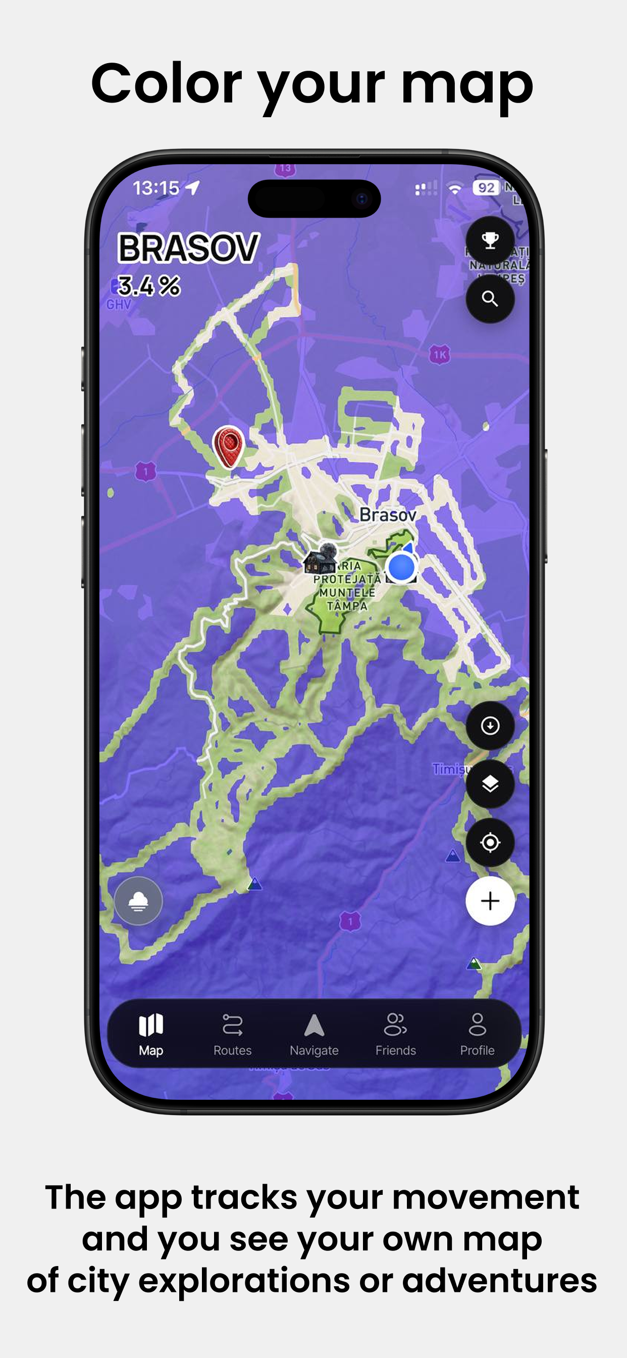
The whole world starts under fog — not a handful of supported countries. Ground you physically cover is the only thing that clears it, so what you end up with is a record rather than a wish list.
- One world fog layer, cleared tile by tile as you move
- Percentages for the city, the region and the country you are standing in
- Real admin regions for any country, fetched when you open it
- Geotagged photos from past trips reveal the ground they were taken on
- Cleared ground syncs to your account and survives a reinstall
- Four base maps, plus relief, contours, trails, city districts and more on top
A route that follows the ground
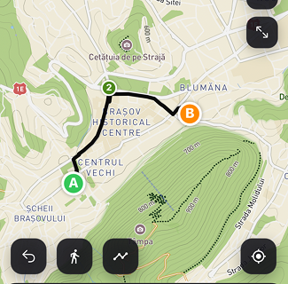
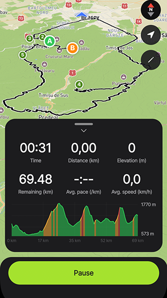
Drop points and the line snaps to real paths between them. Before you leave, you know the climb, the time, the pace and what you will walk past.
- Snap-to-path drawing, or a straight line where there is no path
- Elevation profile, estimated time, pace and difficulty
- The named peaks, lakes, caves, springs, huts and viewpoints along the line, in the order you meet them
- Split a long route into day segments, each with its own colour
- Weather along the way, and an off-route alert if you drift 75 m for half a minute
- Offline map packs for ground with no signal — routing included
Mark what is actually there
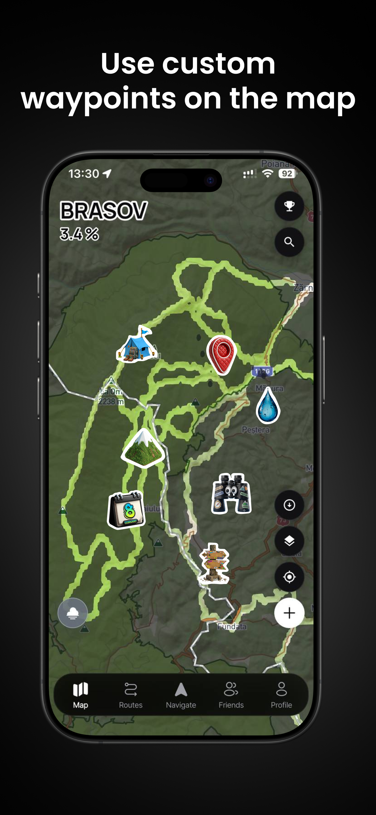
A spring that still runs, the hut with the broken door, the turn the trail sign gets wrong. Drop a point where you are standing and it is on your map for good.
- Long-press on the phone, or hold and right-click on the web: the spot, then what it is, then the details
- Seven kinds — overnight spot, water, navigation, landmark, danger, viewpoint, other — each with its own colour
- A name, notes, and a public-or-private switch on every point
- Hang them off a planned route and its day segments
- Hide one from the map without deleting it — hiding stays on your device
- Saved on the phone or saved here, it lands in the same place
Every activity counts
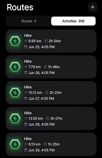
Record live with GPS, or let what you already have arrive on its own. Hiking, running, cycling and walking all feed the same map.
- Live GPS tracking that keeps running with the screen off
- Lock-screen and Dynamic Island Live Activity while you move
- Apple Health reads and writes in the background
- Bulk GPX import that keeps each activity's real date
- Distance, moving time, elevation gain and pace on every activity
- Hundreds of imported activities still open fast
A reason to take the long way
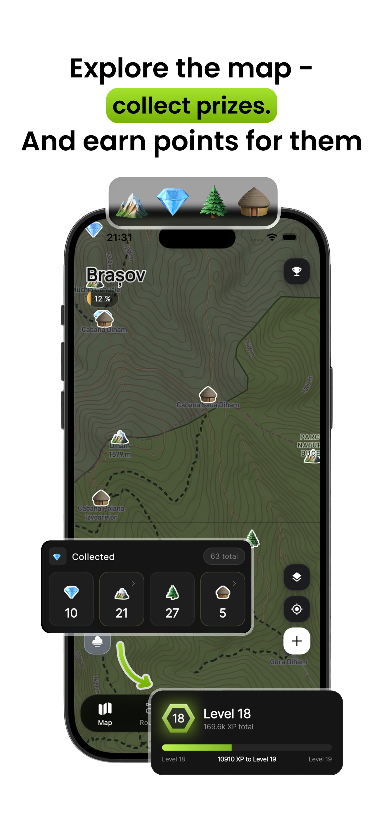
Exploring pays. Gems appear on ground you have not touched, peaks count when you actually stand on them, and the ladder above it all is twenty-four ranks deep.
- Gems, peaks and huts collected by reaching them, not by tapping
- A summit counts within 200 m of the real peak — nearly three thousand catalogued
- Twenty-four explorer titles, each with its own art, some of it wearable on your map
- Thirty-seven awards for distance, countries, continents, peaks and huts
- Streaks with a grace day, weekly challenges, and a login reward across seven days
Bring something back
Your routes tab is a feed — friends, the world, or just yours. Each activity carries its own privacy setting, its photos and its trace.
- Per-activity privacy, from private to public
- Four share formats: a map card, a transparent card, the bare trace, or the raw GPX
- Photos attached to an activity, and green dots where they sit along a route
- Friends on the map, friend profiles and leaderboards for the area you are in
- Collections that bundle routes, activities and waypoints into one trip
- Trips with ordered stops, transport legs and checklists, shared with roles
Three steps, one afternoon
Get the app
It is free, and everything above is in it — no trial, no waiting list.
Walk out of your door
Anything counts. The commute, the dog, the long way to the shop.
Watch the fog open
The first hole appears the moment you move. Then you will want the next street.
Your movement deserves a map
Download it, walk out of your door, and watch the first hole open in the fog.